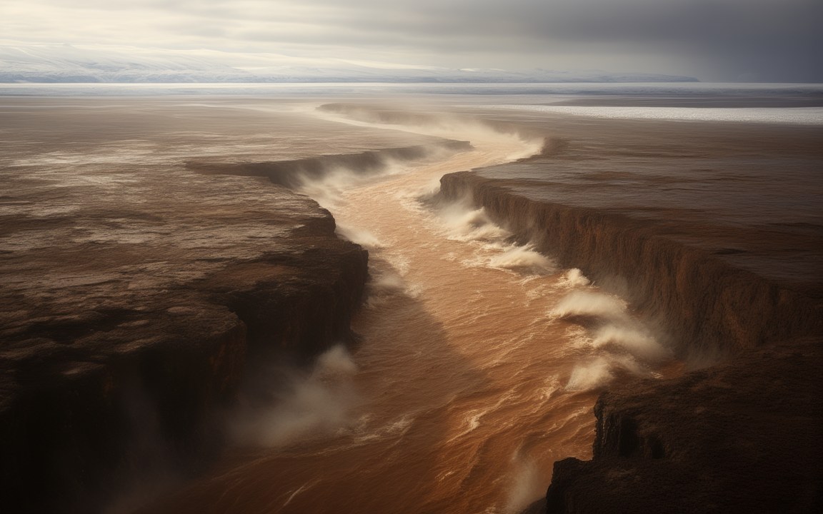
Seen from low above, a torrent of brown, muddy water racing through a deep, steep-sided channel cut into a flat, dark plateau, spray rising from the flood and the white edge of an ice sheet on the far horizon, an impression of one of the Missoula floods tearing across eastern Washington about 16 000 years ago.

Lost WorldsPleistocene

Missoula floods

A glacial lake that kept bursting through its ice dam and emptying across Washington towards the Pacific

About 20 000 to 14 000 years ago Reconstruction, not a photograph
When about 20 000 to 14 000 years ago floods for at least 3 000 to 4 000 years within that span; older accounts give 15 000 to 13 000; the last flood from the lake dated to about 14 700 [8]
Number of floods dozens, likely more than 100 older counts say 40 or more [8]
Time between floods up to about 100 years shrinking to 1 or 2 years for the last few [8]
Glacial Lake Missoula about 7 770 km² about 2 100 km³ of water, perhaps 2 500 km³ at its largest [2]
Depth of the lake more than 600 m at its largest [2]
Ice dam about 1 km thick the Purcell Trench lobe of the Cordilleran ice sheet [8]
Peak flow about 20 million m³/s near the lake 5 to 15 million at Wallula Gap; newer canyon studies give less [8]
Fastest water about 36 m per second about 130 km/h [1]
Channeled Scabland about 30 000 km² coulees and cataracts cut into basalt [8]
Recognised 1923, by Bretz Penrose Medal in 1979, at the age of 96 [4]

About the pictures. Painted as a flood tearing down a canyon through a dark plateau, as the cataract at Dry Falls, as the ice dam and the lake behind it, and as a Columbian mammoth on bare ground. Landforms, flood heights and the ice lobe come from today's scablands, high-water marks and flow models; one channel stands in for many. Today's cliff is the end result of many floods, and at flood peak it lay under deep water, so the falls show a lower stage. A full lake hid most of the dam, so only the top of the ice shows. Mammoth bones come from flood silts, not bare rock; its coat is unknown, and the real animal's tusks curved in towards each other. Water colour, trees and sky are imagined.

Between about 20 000 and 14 000 years ago, a tongue of the Cordilleran ice sheet blocked the Clark Fork valley in northern Idaho and held back a lake in the valleys of western Montana. Dozens of times, and probably more than a hundred, the ice failed and the lake burst out across eastern Washington and down the Columbia towards the Pacific. The floods scoured about 30 000 square kilometres of land and left a landscape so strange that geologists argued over it for some 40 years.

A dam that could float

The ice was about a kilometre thick where it crossed the valley, according to a 2020 review led by O’Connor. Behind it Glacial Lake Missoula grew to about 7 770 square kilometres and about 2 100 cubic kilometres of water, more than 600 m deep at its largest.

Ice floats, and that limits what a glacier can hold back. The US National Park Service puts the release point at about nine-tenths of the height of the ice, so when the lake was full most of the dam lay under water, not standing as a wall above it. In the version set out by Waitt in 1985, the glacier’s bed lifted once the lake reached about 600 m, water began to run underneath, and tunnels widened rapidly into a catastrophic outflow. Then the ice settled and the lake refilled. Other studies favour overtopping or tunnelling.

From Idaho to the Pacific

A flood lasted about a week. The fastest water approached 36 m per second, about 130 km/h. It spread over the plateau of eastern Washington, stripping tens of metres of pale loess from the dark basalt below and cutting canyons, cataracts and potholes. At Wallula Gap, a 3.2 km opening, it slowed and backed up into Lake Lewis. Near Kalama it backed up again into Lake Allison, about 120 m above present sea level as far as Eugene in Oregon. Icebergs rode the water: the Bellevue Erratic, a boulder of about 90 tons, was carried as much as 800 km.

Columbian mammoths lived in the path. Their bones are among the most frequent fossils in the fine flood silts, mostly at 300 to 380 m above sea level, near the top of Lake Lewis. People, in the area since 16 600 to 15 300 years ago, almost certainly witnessed the last of the floods, the 2020 review concludes.

How big they really were

Estimates of peak flow differ widely. O’Connor’s review gives about 20 million cubic metres per second near the lake’s outlet and 5 to 15 million through Wallula Gap, more than ten times the Bonneville flood of about 18 000 years ago. Other estimates for the largest flood are about 2.7 million, 13 times the flow of the Amazon.

Recent work has shrunk the canyon-cutting floods. Lehnigk and Larsen found in 2022 that calculations based on today’s canyons and high-water marks overestimate the discharge by more than 80 per cent. A 2024 study estimated 3.1 million cubic metres per second for the upper Grand Coulee, where floods removed 67.8 cubic kilometres of rock, and found that the largest canyons could have formed in about six floods or fewer.

The geologist nobody believed

In 1923, after fieldwork on the Columbia Plateau, Bretz coined the name Channeled Scabland and argued that massive flooding had carved it. That ran against the uniformitarian view of the time, and he could not yet say where so much water had come from. Pardee, who had described Glacial Lake Missoula in 1910, suggested to him in 1925 that a draining glacial lake could do it. At a meeting in Washington on 12 January 1927 other geologists presented competing theories, and a bitter debate followed for about 40 years. By the 1950s the evidence favoured him, and hydraulic research and NASA satellite images in the 1970s vindicated him further. In 1979, aged 96, Bretz received the Penrose Medal, the Geological Society of America’s highest award. “All my enemies are dead, so I have no one to gloat over,” he told his son.

Where the floods can still be read

The Ice Age Floods National Geologic Trail links sites in four states. Dry Falls is a scalloped cliff about 120 m high and 5.6 km long, and PBS’s NOVA describes floodwaters more than 75 m deep pouring over it. On Camas Prairie in Montana, ripples of gravel stand 5 to 15 m high, and on Mount Sentinel and Mount Jumbo above Missoula, faint lines mark the old shores.
Where it sits in deep time

Missoula floods: About 20 000 to 14 000 years ago, in the Pleistocene.

Missoula floods

Earth forms, 4.57 billion years agoToday

Each step to the right is ten times closer to today, so the last few million years get as much room as the first billion.

If Earth's history were one day

Squeeze all of Earth's history, about 4.6 billion years, into 24 hours, starting at midnight. Missoula floods runs from 23:59:59.62 to 23:59:59.74, ending 0.26 seconds before midnight.

On this clock one second is about 52 862 years. All of written history fits into the last tenth of a second.

How deep

The ice that blocked the valley, the lake behind it, the cliff at Dry Falls and the water that ran over it.

Ice thickness from the 2020 review by O'Connor and colleagues; other accounts of the dam's height run from about 600 m to about 1 200 m. The depth over Dry Falls is a rounded figure from PBS NOVA (more than 250 feet); other accounts say only hundreds of feet.

Reconstructions

Seen from low above, a torrent of brown, muddy water racing through a deep, steep-sided channel cut into a flat, dark plateau, spray rising from the flood and the white edge of an ice sheet on the far horizon, an impression of one of the Missoula floods tearing across eastern Washington about 16 000 years ago. AI-generated painting.
Immense waterfalls of churning brown water pouring over a long, curving cliff of dark rock into a canyon filled with spray, an impression of the cataract at Dry Falls in eastern Washington as an Ice Age flood rose or fell about 16 000 years ago. AI-generated painting.
A wide, crevassed glacier filling a mountain valley and ending low at the edge of a long, grey-green lake with floating ice, a steep wall of blue-white ice along its side and dark conifers on the slopes in front, an impression of the ice dam that held back Glacial Lake Missoula about 16 000 years ago. AI-generated painting.
A brown, short-haired mammoth with a pair of long, curving tusks walking across dark, scoured basalt, a dry canyon wall behind it, an impression of a Columbian mammoth on the land left by the Missoula floods in eastern Washington. AI-generated painting.

Questions people ask

What caused the Missoula floods?

A lobe of the Cordilleran ice sheet blocked the Clark Fork valley in northern Idaho and created Glacial Lake Missoula. Each time the dam failed, perhaps because the rising lake floated the ice (the exact cause is disputed), the water emptied across Washington and Oregon.

How big was Glacial Lake Missoula?

About 7 770 square kilometres, with about 2 100 cubic kilometres of water and more than 600 m deep at its largest. At its fullest it may have held 2 500 cubic kilometres, as much as Lake Erie and Lake Ontario combined.

How many Missoula floods were there?

Dozens, and likely more than 100, between about 20 000 and 14 000 years ago, according to a 2020 review. Older accounts count 40 or more. The gaps between floods shrank from up to about 100 years to one or two.

How fast and how large were the floods?

The fastest water approached 36 m per second, about 130 km/h. Peak-flow estimates differ widely: about 20 million cubic metres per second near the lake in a 2020 review, about 2.7 million in other estimates, and 3.1 million for the upper Grand Coulee in a 2024 study.

Why was Bretz's flood theory rejected?

It required a sudden catastrophe, which clashed with the uniformitarian thinking of the 1920s, and at first he could not say where so much water came from. The debate lasted about 40 years. He received geology's Penrose Medal in 1979.

Where can you see evidence of the Missoula floods?

Along the Ice Age Floods National Geologic Trail in Montana, Idaho, Washington and Oregon. Dry Falls, the Channeled Scabland, the Camas Prairie ripples, the old shorelines above Missoula and the Bellevue Erratic are among its sites.

Sources

  1. Wikipedia: Missoula floods
  2. Wikipedia: Glacial Lake Missoula
  3. Wikipedia: Channeled Scablands
  4. Wikipedia: J Harlen Bretz
  5. Wikipedia: Dry Falls
  6. Wikipedia: Ice Age Floods National Geologic Trail
  7. PBS NOVA, Mystery of the Megaflood: Explore the Scablands (Dry Falls)
  8. O'Connor et al. (2020), The Missoula and Bonneville floods: a review of ice-age megafloods in the Columbia River basin, Earth-Science Reviews 208, 103181
  9. Waitt (1985), Case for periodic, colossal jökulhlaups from Pleistocene glacial Lake Missoula, GSA Bulletin 96, 1271
  10. Balbas et al. (2017), 10Be dating of late Pleistocene megafloods and Cordilleran Ice Sheet retreat in the northwestern United States, Geology 45, 583
  11. Denlinger et al. (2021), Diverse cataclysmic floods from Pleistocene glacial Lake Missoula, GSA Special Paper 548
  12. Lehnigk et al. (2024), Rates of bedrock canyon incision by megafloods, Channeled Scabland, eastern Washington, USA, GSA Bulletin
  13. Eos (2022), Western U.S. megafloods might not have been so mega (Lehnigk and Larsen, JGR Earth Surface)
  14. Last and Winsor (2007), Impacts of Ice Age floods on Pleistocene mammoths of southeastern Washington, GSA abstract
  15. US National Park Service: Ice Age Floods
  16. US National Park Service: Clark Fork Ice Dam
  17. US National Park Service: Glacial Lake Missoula National Natural Landmark, Camas Prairie Ripples
  18. US National Park Service: Erratic Rock State Natural Site (Bellevue Erratic)