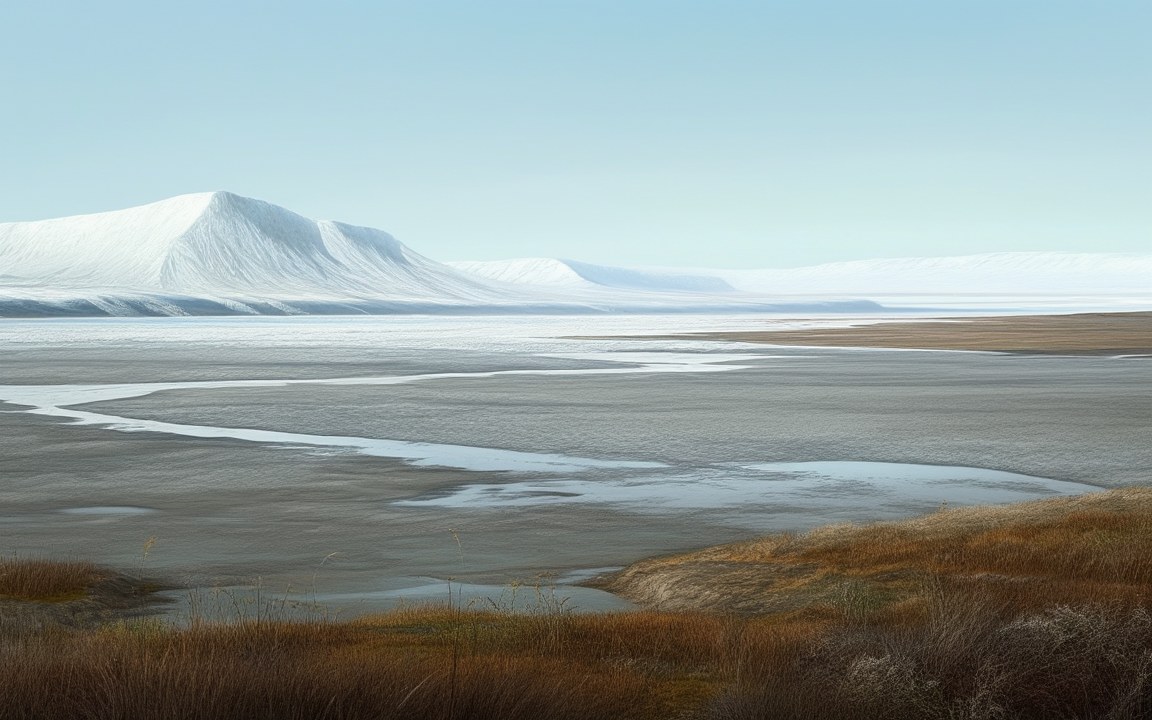
The white edge of an ice sheet rising on the horizon beyond a wide, flat plain of grey gravel and braided meltwater channels, golden tundra plants in the foreground, an impression of the southern edge of the North American ice sheet about 21 000 years ago.

Lost WorldsPleistocene

Last Glacial Maximum

The coldest stretch of the last Ice Age, when ice stood more than 3 km high over Canada and the sea lay about 120 to 130 m lower

About 26 500 to 19 000 years ago Reconstruction, not a photograph
Ice at its limits about 26 500 to 19 000 years ago from 5 704 dated samples; there are no agreed dates, and others use 26 000 to 20 000 [7]
Global temperature about 6 °C colder than today about 14 °C colder in the Arctic [9]
Sea level about 120 to 130 m lower a 2018 study: global low of 125 to 130 m about 20 500 years ago, and 118 m on the Great Barrier Reef itself [11]
Carbon dioxide about 180 ppm against about 280 ppm before the Industrial Revolution [10]
Ice in North America almost all of Canada south roughly to the Missouri and Ohio rivers, and east to Manhattan [1]
Ice in Europe south to Germany and Poland with all of Iceland and Ireland and the north of Britain [1]
Stayed free of ice most of Alaska too dry for an ice sheet to form [2]
Dust in the air up to 20 to 25 times today's levels from ice cores [1]
People in Europe down by up to 60% an estimate; one ancestry survived in the south-west [1]
What remains the Barnes and Penny ice caps remnants of the Laurentide, on Baffin Island [3]

About the pictures. Painted as the edge of the North American ice beyond a gravel plain, as two hunters crossing a dry steppe in south-western France, and as a warm spring with a small grove in central Europe. The ice limits come from dated glacial deposits, the grove from fossil leaves and pollen, and the hunters' place from Solutrean sites. Solutrean spear points were finely flaked flint, while the long, dark heads shown here are smoother. The shape of the ice front, the clothing, the species of the trees and animals, light and weather are imagined.

The Last Glacial Maximum was the coldest stretch of the last Ice Age, when the great ice sheets reached their limits. Between about 26 500 and 19 000 years ago ice lay over almost all of Canada and the north of Europe, the world averaged about 6 °C colder than today, and the sea stood about 120 to 130 m below its present level. It is among the best studied climates of the past, because it shows how the whole planet responds to lower greenhouse gases and vast sheets of ice.

Where the ice stopped

The largest sheet, the Laurentide, covered essentially all of Canada east of the Rocky Mountains and reached roughly to the Missouri and Ohio rivers and east to Manhattan. At its highest, around the Keewatin Dome, the surface stood 3.2 km above sea level, but near the edge it was far thinner: about 610 m over Manhattan.

In Europe, ice covered all of Iceland and Ireland and roughly the northern half of Britain. Its southern edge ran through Germany and Poland, and in the east it reached as far as the Taymyr Peninsula in Siberia. Far to the south, the Patagonian ice sheet ran along the Andes from about 35°S to 55°S.

The planet was not white from pole to pole. Alaska stayed mostly free of ice because its climate was too dry. The Arctic Ocean was not frozen throughout: sediment cores suggest shallow seasonal ice riddled with icebergs, with spells of open water. The cold reached further than the ice, with permafrost as far south as Szeged in Hungary and Beijing in China.

Dating the peak

A 2009 study led by Clark compiled 5 704 radiocarbon and other ages from ice sheets and mountain glaciers. It found the ice growing to its limits between 33 000 and 26 500 years ago and holding nearly all those positions until 19 000 to 20 000 years ago, when rising summer sunlight in the north started the melt.

The temperature comes from a 2020 reconstruction led by Tierney, which combined chemical signals in ocean plankton fossils with climate models: about 6 °C of global cooling, and about 14 °C in the Arctic.

A lower sea and a dustier sky

With so much water held in ice, the sea fell. The figure given by the US Geological Survey is about 125 m. A 2018 study led by Yokoyama used fossil corals from the edge of the Great Barrier Reef and found that sea level there dropped by about 20 m between 21 900 and 20 500 years ago, to 118 m below today’s. Allowing for the way the Earth responds to the weight of ice and water, the team calculated a global low of about 125 to 130 m. That gap between local and global sea level is one reason figures from about 120 to 130 m are all quoted.

The fall turned shelves into land. Beringia joined Asia to Alaska, Doggerland joined Britain to Europe, Sundaland tied Borneo and Bali to Asia, and Australia, New Guinea and Tasmania became a single land called Sahul.

The world was dry as well as cold. Ice cores show dust levels as much as 20 to 25 times today’s. The Sahara and other sandy deserts spread, shifting dunes covered half of Australia, and rainforest in West Africa shrank greatly. Savanna may have split the Amazon rainforest into two blocks, though how far that forest shrank is still debated.

Survivors in the south-west

Europe’s human population may have fallen by as much as 60 per cent. A 2023 study led by Posth compared 356 genomes of ancient hunter-gatherers and found that one ancestry came through the coldest millennia, about 25 000 to 19 000 years ago, in south-western Europe. It belonged to people of the Solutrean culture, known from sites in France, Spain and Portugal for finely worked flint points. The study found no sign that Italy had served as a refuge.

Oak and ash beside a warm spring

A few temperate trees held on in unlikely places. In the Vienna Basin in central Europe, a 2024 study led by Hošek reported leaves, wood and pollen dated to between 19 000 and 26 000 years ago, including oak, linden and common ash, in what was otherwise a periglacial desert. Springs at 15 to 35 °C kept a small area humid and mild. The authors call it the first unequivocal fossil proof that such trees survived the cold in central Europe.
Where it sits in deep time

Last Glacial Maximum: About 26 500 to 19 000 years ago, in the Pleistocene.

Last Glacial Maximum

Earth forms, 4.57 billion years agoToday

Each step to the right is ten times closer to today, so the last few million years get as much room as the first billion.

If Earth's history were one day

Squeeze all of Earth's history, about 4.6 billion years, into 24 hours, starting at midnight. Last Glacial Maximum runs from 23:59:59.50 to 23:59:59.64, ending 0.36 seconds before midnight.

On this clock one second is about 52 862 years. All of written history fits into the last tenth of a second.

How high, how low

The highest point of the North American ice, its thickness near the southern edge, and the fall in sea level.

The ice figures are reconstructions. Estimates of the fall in sea level run from about 120 m to about 130 m; the bar shows the US Geological Survey figure, and a 2018 coral study puts the global low at 125 to 130 m.

Reconstructions

The white edge of an ice sheet rising on the horizon beyond a wide, flat plain of grey gravel and braided meltwater channels, golden tundra plants in the foreground, an impression of the southern edge of the North American ice sheet about 21 000 years ago. AI-generated painting.
Two hunters in heavy fur clothing, seen from behind, walking with long spears across a golden steppe towards a distant herd of grazing animals, a rocky valley behind them, an impression of Ice Age hunters in southern France about 21 000 years ago. AI-generated painting.
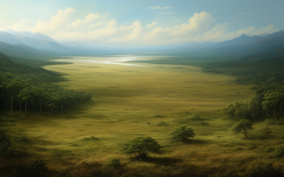
A steaming warm spring in a hollow of a dry, windswept grassland, a small grove of green trees beside it and dust blowing across the plain under a grey sky, an impression of a rare refuge for trees in central Europe about 21 000 years ago. AI-generated painting.

Questions people ask

When was the Last Glacial Maximum?

Nearly all ice sheets stood at their limits from about 26 500 years ago until 19 000 to 20 000 years ago, according to a 2009 study of 5 704 dated samples. There are no agreed dates, and other authors use about 26 000 to 20 000 years ago.

How cold was the Last Glacial Maximum?

About 6 °C colder than today on global average, and about 14 °C colder in the Arctic, according to a 2020 reconstruction that combined ocean plankton fossils with climate models.

How much lower was the sea?

About 120 to 130 m. The US Geological Survey gives about 125 m, and a 2018 study of Great Barrier Reef corals 125 to 130 m. Figures near 120 m are also quoted, partly because sea level in one place can differ from the global average.

How thick was the ice?

The big northern ice sheets were three to four kilometres thick. The Laurentide sheet reached 3.2 km above sea level at the Keewatin Dome, and was about 610 m thick over Manhattan, close to its edge.

Where did people live during the Last Glacial Maximum?

In Europe, one ancestry survived the coldest millennia in the south-west, among people of the Solutrean culture in France, Spain and Portugal. Estimates suggest Europe's population fell by up to 60 per cent.

Is the Last Glacial Maximum the same as the Ice Age?

No. It is the coldest stretch of the Last Glacial Period, which ran from about 115 000 to 11 700 years ago.

Sources

  1. Wikipedia: Last Glacial Maximum
  2. Wikipedia: Last Glacial Period
  3. Wikipedia: Laurentide ice sheet
  4. Wikipedia: Solutrean
  5. Wikipedia: Amazon rainforest
  6. Poore, Williams and Tracey, Sea Level and Climate, US Geological Survey Fact Sheet 002-00
  7. Clark et al. (2009), The Last Glacial Maximum, Science 325, 710
  8. Tierney et al. (2020), Glacial cooling and climate sensitivity revisited, Nature 584, 569
  9. University of Arizona (2020), How cold was the ice age? Researchers now know (Tierney et al., Nature)
  10. Futurity (2020), We finally know how cold the last ice age was
  11. Yokoyama et al. (2018), Rapid glaciation and a two-step sea level plunge into the Last Glacial Maximum, Nature 559, 603
  12. Australian National University (2018), Ice age sea-level drops not caused by CO2-level changes
  13. Posth et al. (2023), Palaeogenomics of Upper Palaeolithic to Neolithic European hunter-gatherers, Nature 615, 117
  14. Phys.org (2023), Ice Age survivors: Paleogenomics study (Posth et al., Nature)
  15. Hošek et al. (2024), Hot spring oases in the periglacial desert as the Last Glacial Maximum refugia for temperate trees in Central Europe, Science Advances 10, eado6611
  16. Phys.org (2024), Scientists find evidence of hot spring oasis during last ice age in central Europe (Hošek et al., Science Advances)