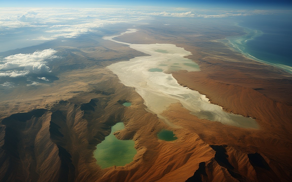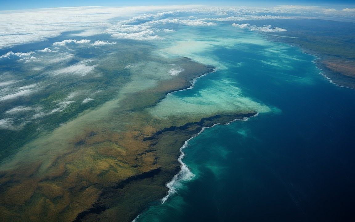
Seen from high above, a long coast where pale turquoise shallows over white banks border a deep blue ocean, green and brown land beyond under scattered clouds, an impression of the warm, shallow margins of the Tethys Ocean about 120 million years ago.

Lost WorldsTriassic

Tethys Ocean

The tropical ocean that once split the continents, now folded into mountains from the Alps to the Himalaya

About 250 to 14 million years ago Reconstruction, not a photograph
Lay between Laurasia and Gondwana later Eurasia to the north, Africa and India to the south [1]
Formed from about 250 million years ago as the Cimmerian blocks broke away from Gondwana [1]
Before it the Paleo-Tethys about 400 million years old when it closed in the Late Triassic [2]
Greatest width 7 100 km north to south ± 530 km, about 132 million years ago [15]
Latitude about 30° N to the equator at its widest extent, part of a belt of ocean around the Earth [1]
Named 1893, by Suess after a Greek sea goddess; Neumayr had described the seaway in the 1880s [1]
Cretaceous reefs often rudist clams sometimes hundreds of metres tall; they may have driven corals from many tropical shelves [7]
Slab on land the Semail ophiolite, Oman about 100 000 km² of ocean crust and mantle, about 95 million years old, one of the world's largest [10]
Last link closed about 13.8 million years ago exchange with the Indian Ocean had already fallen by about 90% at about 20 million years ago [13]
Descendants the Indian Ocean, Mediterranean, Black Sea and Caspian [1]

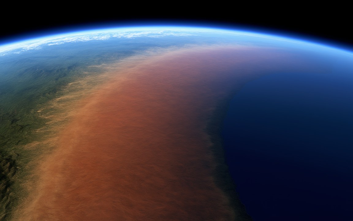
About the pictures. Painted at three moments, because the ocean changed shape completely: from high above as a warm coast with pale shallows over carbonate banks about 120 million years ago; from space as a wedge-shaped bay inside Pangaea about 230 million years ago, with a string of islands standing for the Cimmerian blocks; and as a sea floor of nummulites about 45 million years ago. Layouts follow plate reconstructions, and the sea floor follows fossils and limestones. Coastlines, colours and light are imagined. Real nummulites were lens-shaped coils, usually 13 to 50 mm across.

For more than 200 million years a warm ocean lay between the northern and southern continents. The Tethys began to form about 250 million years ago along the northern edge of Gondwana, came to lie between it and Laurasia, and reached about 7 100 km from north to south at its widest. Then the continents closed it. Much of its floor sank under Eurasia, its rocks rose into mountains from the Alps to the Himalaya, and its last link to the Indian Ocean was cut about 14 million years ago. The Mediterranean, the Black Sea and the Caspian are what remains.

One name, several oceans

The word Tethys covers a chain of oceans, which is why accounts give different dates. While Pangaea was whole, the sea inside its curve, often just called the Tethys, was strictly the Paleo-Tethys, which had begun to open along Gondwana’s northern edge in the Middle Cambrian. About 250 million years ago a long strip of that edge broke away. These Cimmerian blocks now underlie Turkey, Iran, Tibet and parts of South-East Asia. As the strip moved north it shut the old ocean in front of it and opened a new one behind it, called the Neo-Tethys or simply the Tethys. The strip had finished colliding with Laurasia by about 150 million years ago.

A belt of warm shallows

By the Early Cretaceous the Tethys formed part of a belt of ocean around the Earth between about 30° N and the equator. A 2022 study of magnetism in Tibetan rocks found it was widest about 132 million years ago and had shrunk to about 6 400 km by about 115 million years ago. About 120 million years ago India was still joined to Madagascar.

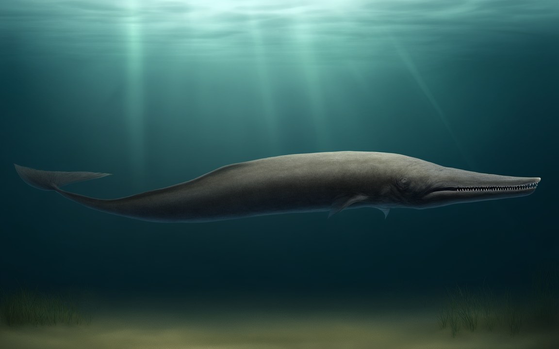
Its life changed with the ages. In the Middle Triassic, a basin now at Monte San Giorgio in Switzerland probably had bottom water too short of oxygen for most seabed life, and marine reptiles, fish and shelled cephalopods settled into its mud. Many Cretaceous reefs were built by rudists, clams with a cone-shaped shell capped by a flat lid, from a few centimetres to over a metre long. Their reefs were sometimes hundreds of metres tall. In the Eocene, nummulites, single-celled organisms with coin-like shells usually 13 to 50 mm across, filled limestones later used in the Egyptian pyramids, and Basilosaurus left its bones in Tethys sediments at Wadi Al Hitan in Egypt.

Seafloor on dry land

Neumayr deduced a central seaway from marine sediments in the 1880s, and in 1893 Suess named it after a Greek sea goddess, using fossils from the Alps and Africa. He thought of it as a sea; plate tectonics in the 1960s showed an ocean, whose floor could vanish by subduction.

Some of that floor escaped. The Semail ophiolite of Oman and the United Arab Emirates, formed about 95 million years ago, is about 100 000 km² of Tethyan crust and upper mantle thrust onto the edge of Arabia, in a sheet roughly 15 to 20 km thick. Under the eastern Mediterranean, magnetic surveys published in 2016 suggest seafloor about 340 million years old, within a range of 315 to 365, although most ocean crust is younger than 200 million years. It is thought to be a remnant of the Tethys, which would make it older than the Neo-Tethys. Even the floor that sank left a mark: a 2026 study links short bursts of mountain-building in Central Asia to the roll-back of sinking Tethys slabs, up to thousands of kilometres away.

Closing the gates

The collision of India and Asia is dated differently: 61.7 million years ago in the 2022 study, assuming a single collision, 55 million in other accounts, and 40 to 50 million according to the US Geological Survey.

Arabia cut the last link. Boreholes in the eastern Mediterranean show a pulse of sediment 24 to 21 million years ago, tied to its collision with Eurasia and an effective closure. Bialik and colleagues found that water exchange fell by about 90 per cent at about 20 million years ago and ended about 13.8 million years ago, when Antarctic ice lowered the sea. From about 19 million years ago a land bridge let elephant relatives leave Africa, and the changed currents paved the way for upwelling in the Arabian Sea and possibly a stronger South Asian monsoon.

The northern arm, the Paratethys, was cut off about 34 million years ago, and about 12 million years ago became a megalake of more than 2.8 million km², with miniature whales and seals. The Mediterranean, left with one link to the Atlantic, was later able to dry out.
Where it sits in deep time

Tethys Ocean: About 250 to 14 million years ago, in the Triassic.

Tethys Ocean

Earth forms, 4.57 billion years agoToday

Each step to the right is ten times closer to today, so the last few million years get as much room as the first billion.

If Earth's history were one day

Squeeze all of Earth's history, about 4.6 billion years, into 24 hours, starting at midnight. Tethys Ocean runs from 22:41:11 to 23:55:35, ending 4 minutes before midnight.

On this clock one second is about 52 862 years. All of written history fits into the last tenth of a second.

How wide

The Tethys from north to south at its widest and 17 million years later, next to the length of the Himalaya today.

Widths come from one study of magnetism in rocks from Tibet, with errors of ± 530 and ± 550 km. The length of the Himalaya is from the US Geological Survey.

Reconstructions

Seen from high above, a long coast where pale turquoise shallows over white banks border a deep blue ocean, green and brown land beyond under scattered clouds, an impression of the warm, shallow margins of the Tethys Ocean about 120 million years ago. AI-generated painting.
Seen from space, a vast, wedge-shaped bay of deep blue tropical sea with pale turquoise shallows, enclosed by dry red and brown land, with a string of narrow islands near its far shore, an impression of the Tethys Ocean inside the curve of Pangaea about 230 million years ago. AI-generated painting.
A sandy seafloor covered as far as the eye can see with thousands of round, domed shells half buried under shafts of sunlight in green-blue water, an impression of the nummulite banks of the Tethys sea about 45 million years ago. AI-generated painting.

Questions people ask

What happened to the Tethys Ocean?

Its floor was consumed under Eurasia as Africa, Arabia and India moved north, raising mountains from the Alps to the Himalaya. The last seaway between the future Mediterranean and the Indian Ocean closed about 13.8 million years ago according to a 2019 study, though another study puts the effective closure at 24 to 21 million years ago.

Is the Mediterranean part of the Tethys Ocean?

It is a descendant, left behind when the link to the Indian Ocean closed. The Black Sea and the Caspian descend from the Paratethys, a northern arm cut off about 34 million years ago. A 2016 study proposed that some seafloor under the eastern Mediterranean is about 340 million years old, within a range of 315 to 365.

How big was the Tethys Ocean?

One study of magnetism in rocks from Tibet puts the Neo-Tethys at 7 100 km from north to south at its widest, about 132 million years ago, give or take 530 km. It had narrowed to about 6 400 km by about 115 million years ago.

Who named the Tethys Ocean?

The geologist Suess, in 1893, after a Greek sea goddess. Neumayr had already deduced a central seaway from marine sediments in the 1880s. Suess thought of it as a sea, and only plate tectonics in the 1960s showed that it had been a true ocean.

Why are there sea fossils in the Himalaya?

Because rock laid down in or beside the Tethys was lifted when India collided with Asia. Sandstones north of Lhasa, for example, hold fossils from times when the Tethys periodically flooded the region.

What lived in the Tethys Ocean?

It depends on the age. Marine reptiles and fish in the Triassic, reefs of rudist clams in the Cretaceous, then nummulites and early whales in the Eocene. These groups lived tens of millions of years apart.

Sources

  1. Wikipedia: Tethys Ocean
  2. Wikipedia: Paleo-Tethys Ocean
  3. Wikipedia: Cimmeria (continent)
  4. Wikipedia: Paratethys
  5. Wikipedia: Madagascar
  6. Wikipedia: Insular India
  7. Wikipedia: Rudists
  8. Wikipedia: Nummulite
  9. Wikipedia: Monte San Giorgio
  10. Wikipedia: Samail Ophiolite
  11. Wikipedia: Gomphotherium land bridge
  12. Wikipedia: Proboscidea
  13. Bialik et al. (2019), Two-step closure of the Miocene Indian Ocean Gateway to the Mediterranean, Scientific Reports 9, 8842
  14. Torfstein & Steinberg (2020), The Oligo-Miocene closure of the Tethys Ocean and evolution of the proto-Mediterranean Sea, Scientific Reports 10, 13817
  15. Li et al. (2022), New paleomagnetic constraints on the Early Cretaceous paleolatitude of the Lhasa terrane (Tibet), Frontiers in Earth Science 10
  16. USGS, This Dynamic Earth: The Himalayas, two continents collide
  17. Pilia et al. (2015), UAE-Oman mountains give clues to oceanic crust and mantle rocks, Eos 96
  18. Yale Environment 360 (2016), Researchers discover ocean crust dating back 340 million years (Granot, Nature Geoscience 9, 701–705)
  19. Adelaide University (2026), A mighty ancient ocean shaped Central Asia's landscape (Boone & Glorie, Communications Earth & Environment)
  20. Voss et al. (2019), Stomach contents of the archaeocete Basilosaurus isis: apex predator in oceans of the late Eocene, PLOS ONE 14, e0209021